Friday May 31st, 2024
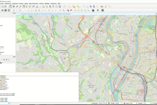
(Fr) Plugin QGIS French Locator Filter 1.1.0 : API Photon et personnalisation avancée !
Sorry, this entry is only available in French.
Read More
🗺 Contact :
Tour De L’Horloge – 4 Place Louis Armand – 75012 PARIS
infos@oslandia.com | +33 184 170 757

© 2025 Oslandia.

Recent Comments