It had been a quite long time since the last Deeposlandia release, isn’t it?
We are pleased to announce that we’ve just released the 0.6.3post1 version of Deeposlandia, our automatic image analysis library. And as happiness never comes alone, we are even more pleased to make the first initial 0.1.0 release of a neighboring QGIS Plugin, called QDeepLandia!
What’s new?
In the last version of this open source project, a huge step has been done forward in order to consider georeferenced dataset. We can now postprocess them, build vectorized version of neural network predictions, and design cleaner predicted rasters in the same move. As a consequence, if you get some big rasters as input, you can process them with Deeposlandia, which will predict ground class on elementary tiles on the first hand, and which will rebuild a semantically segmentized version of the big original image.
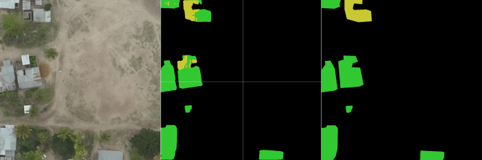
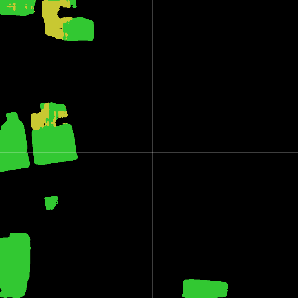
Semantic segmentation on a 1000*1000 pixels georeferenced raster
The figure above shows an example of prediction, with (a) the initial (big) input, (b) the neural network output, with a slight gray grid that materializes working tiles and (c) the final output raster.
How to use the code?
Deeposlandia
We recently migrated to Gitlab, however you can still recover the source code by cloning the Gitlab repo and install it on your system with the commands detailed in the README file. You can even get it straightforwardly by having a look on Pypi, and by doing pip install.
We’ve kind of simplified the Deeposlandia usage. There is a brand new Command-Line Interface!
By taking the Tanzania dataset as an example, you can generate a bunch of exploitable tiles starting from the original images:
$ deepo datagen -D tanzania -s 512 -T 10
Then a deep learning model may still be trained:
$ deepo train -D tanzania -s 512
The inference process evolved for georeferenced dataset, especially regarding aerial images. We can infer or postprocess any testing image. By the way, the first image of the article was generated with the following command:
$ deepo postprocess -D tanzania -s 512 -i tanzania_sample -P tests/data -g
These commands are highly configurable, do not hesitate to take a look at the README file of the project on Gitlab.
QDeepLandia
This is our newbie project, and in this respect we feel a particular tenderness towards it!
We are still dealing with teething problems (0.1.0 bugs, you know what it is…), however we are really proud to get our first semantic segmentation results within QGIS! No doubt that it will pave the way for AI in QGIS.
What’s possible with it? Loading a trained model, doing inference on a raster layer (or a subset of it) ; we exploit the Deeposlandia API in order to get the prediction, and design QGIS processings to do the job.
It is not magic, it is AI; then the prediction process can be quite long especially if the raster is big and the computer small (and without GPU…), however the results looks really promising!
The next steps
We plan to work on QDeepLandia to make its usage as simple as possible. We hope that we will be able to boost its performances, until it becomes possible to introduce it into a production environment.
Contributions are welcome, so are fundings if you think this tool could cover your needs.
We will be pleased to interact with you about this project, so feel free to contact us by email (infos+data@oslandia.com) or through Gitlab issues! We are waiting for you there to exchange views about this exciting topic!


Bravo pour ces progrès sur Deeposlandia, et bienvenue au petit dernier, QDeepLandia !