
The city of Megève has renewed its confidence in Oslandia by asking us to add functionalities to LandSurveyCodesImport (LCSI), a QGIS plugin for geo-coding topographic surveys.
What is a coded survey ?
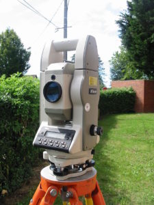
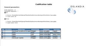
A coded survey is a land survey (carried out with a total station or a GPS) where each point is associated with one or more codes in the field book.
(Thanks Wikipedia for the illustration)
The coding automatically assigns the drawn objects to the correct drawing layer.
The landSurveyCodesImport plugin which allows to retrieve coded data through QGIS, was initially developed by Loïc Bartoletti.
News !
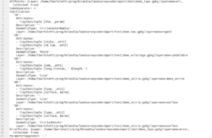
Support for curves, rectangles and squares
It is now possible to code rectangles and squares. To make this possible it was necessary to modify the QGIS API in order to propose to developers functions on these geometries. Consequently the plugin is compatible with QGIS versions higher than 3.6.
Curves are now available on the lines. It is possible to combine straight lines and curves, as on QGIS. The code of the line takes the parameter ‘3’ to indicate that it is a curve. A curve being an arc built with 3 points, it is necessary to draw 3 points with this parameter to build the arc (if it is not the case, the geometry is moved on the errors).
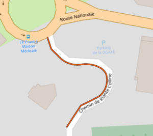
Surveyors managing roads or public spaces will have fun 🙂
Data converter
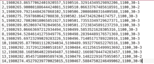
The LSCI plugin can now convert Trimble JobXML data to its CSV format.
Although this can be done from Trimble branded field notebooks, some design offices need to modify JobXML source files to another format afterwards. Version 0.20 offered a reduced field-based functionality to export close to the standard CSV of Trimble field notebooks (Reduction part of the XML file). Version 0.21 goes further by proposing to export all points entered in the field (including deleted points).
PDF output
Codified surveying is good, but being able to bring your codification afterwards when you have a memory lapse, is better. This new treatment solves that problem.
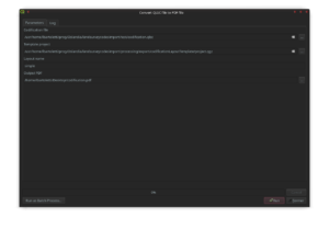
It is possible to export its coding in the field after PDF generation.
Going further
This functional set deserves several improvements, for example :
- support splines: we’re working on adding nurbs in QGIS.
- support other input formats (Leica)
- add ellipses
- automatically propose an envelope (convex, concave, minimum rectangle) for the surveyed property
- improve the PDF export of the codification
- improve the logs from imports
Do not hesitate to contact us if you are interested in these issues!
We plan to integrate in QGIS new drawing functionalities for land surveying and also to work on an OpenHardware/OpenSource surveying device soon, follow our work 🙂


Je m’appelle Darluche LIKIBI,actuellement je suis Sigiste dans une entreprise de BTP pour un projet d’adduction en potable.
Ainsi je vois passé beaucoup dinfo topo car mon le responsable topo fais le récolement.
Je suis très heureux de cette nouvelle et compte bien m’impliquer pour la metrise de ce mixage innovant.
Cordialement.
Hello Loic. Article tres intéressant.
Bravo déjà pour le travail abbatu. J’ai eu à faire quelque chose dans le même sens que votre travail mais cette fois avec des formats Leica. Je vous propose de consulter l’article sur LinkedIn:
https://www.linkedin.com/pulse/automatisation-du-filtrage-et-codification-des-fichiers-derrick
Et la version 2 avec interface graphique.
https://www.linkedin.com/pulse/fatigu%C3%A9-des-longs-traitements-et-filtrages-fichiers-idx-derrick