Piero: a new OpenSource 3D web app for GIS/BIM
![]() Oslandia announces the release of Piero, an opensource application dedicated to digital twins. Piero is a web application based on Giro3D, offering integrated and user-friendly features for visualizing 3D georeferenced data, coming either from the BIM world or from the GIS world.
Oslandia announces the release of Piero, an opensource application dedicated to digital twins. Piero is a web application based on Giro3D, offering integrated and user-friendly features for visualizing 3D georeferenced data, coming either from the BIM world or from the GIS world.
Ready to use, Piero is available for demonstration at the following address:
https://app.giro3d.org/
Pre-loaded examples are provided, and you can easily start without a single line of code by dragging and dropping your data!
History
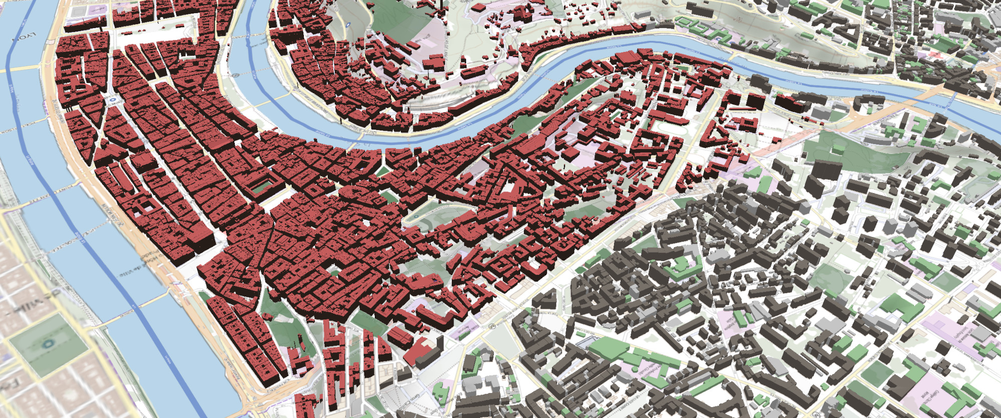
Giro3D is a framework for visualizing and handling 2D, 2.5D and 3D GIS data, directly in the browser. This framework can be integrated into any web application, which makes it very versatile. We recently featured LiDAR and WebGL (in French), two of the technologies used by Giro3D.
As a framework, Giro3D is intended for developers and requires some integration efforts. To address broader use cases and showcase Giro3D’s features, Oslandia has developed a complete application on top of Giro3D, with a user-friendly interface and advanced features for data visualization and analysis.
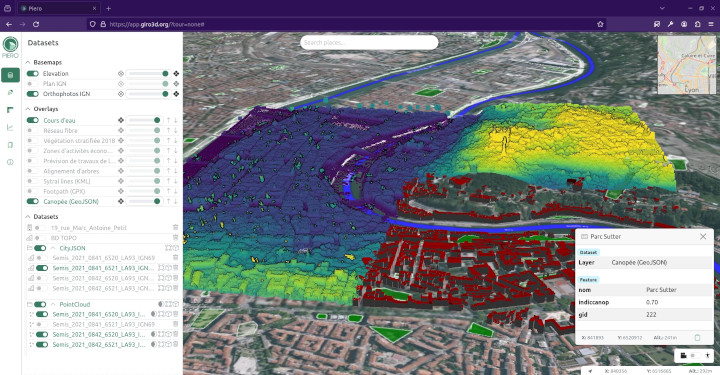
This application, named Piero, is now mature enough to serve as a fully-fledged web application. Leveraging Giro3D and the THREE.js 3D engine to merge the GIS and BIM worlds, Piero is a complete application complète based on Vue.js. Similar to Giro3D, Piero is free, open-source, and its source code is available on GitLab under the MIT license.
Data Formats
In addition to the formats natively supported by Giro3D, Piero covers a wide range of formats, from basic CSV point clouds to very detailed IFC models, including CityJSON, GeoPackage, Shapefile, etc. It also supports OGC web services.
The complete list is available on the project page. New format support is continuously added based on needs. If your preferred format is not supported yet, feel free to let us know. As an open-source and community-driven project, contributions to add data format implementations are also welcome.
Features
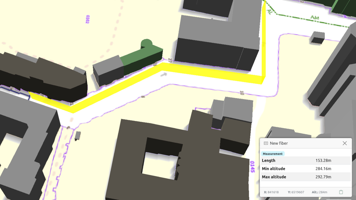
Piero goes beyond visualization. From simple identification, as found in QGIS, to annotations and measurements, including cross-sections and clipping boxes, the application provides tools to easily analyze your 3D data. The feature list continus to grow; visit the GitLab page for more detailed information.
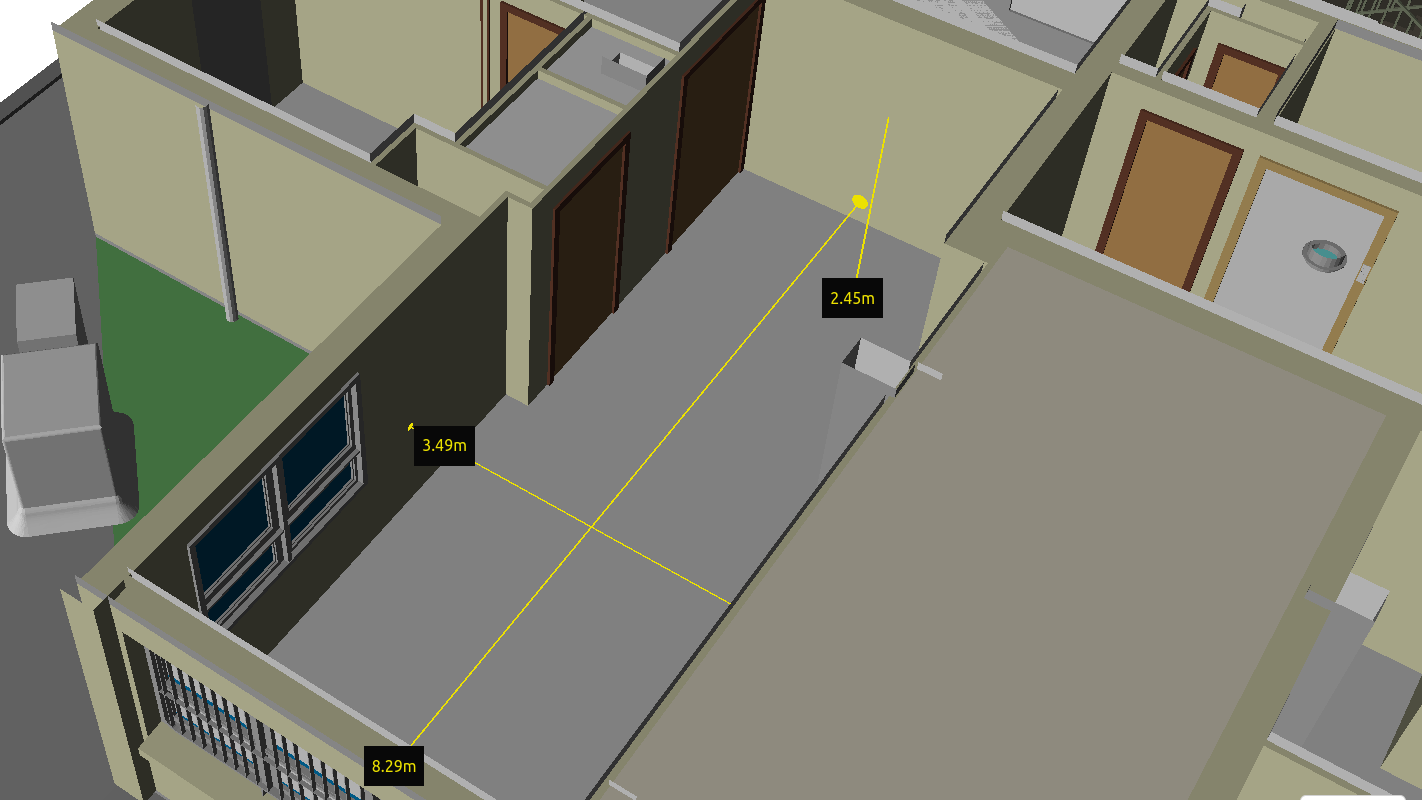
Some notable features include:
- Measurement between planes with automatic plane detection (e.g., from wall to wall in a building),
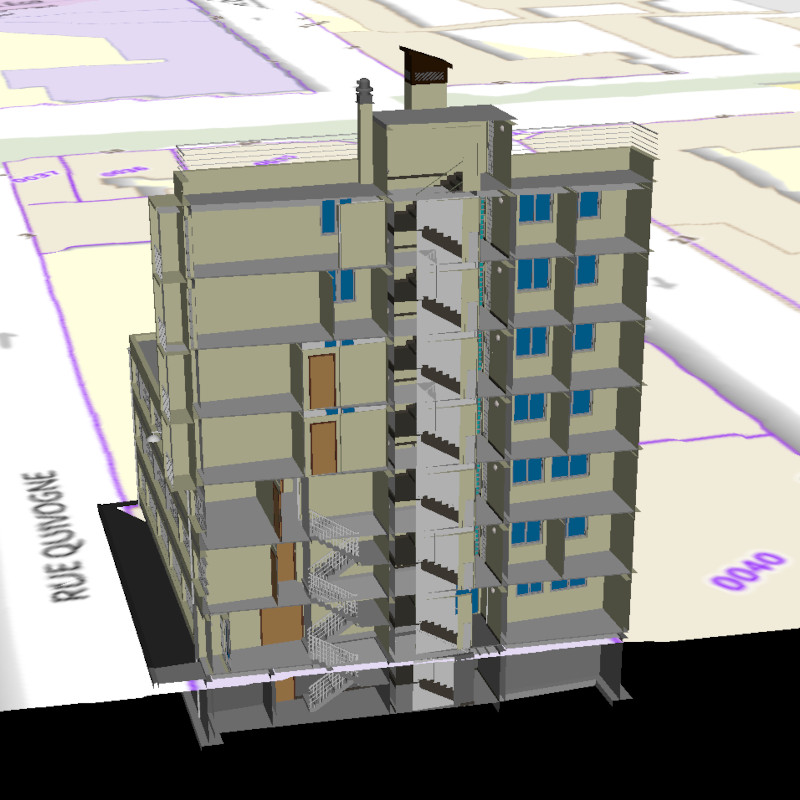
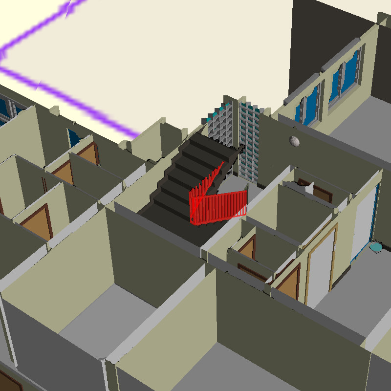
- Clipping box for cutting the inside or outside of a box, useful for visualizing 3D elements in buildings,
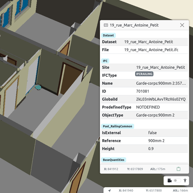
- Querying IFC objects with all their attributes,
- 3D annotations and geo-bookmarks.
Customization
If drag-and-drop data usage is not enough, or if your data is located outside metropolitan France, you can host your own instance of Piero. By editing the configuration through a simple file, you can modify the extent and data sources. Since the application is static (JavaScript and CSS), regenerating and deploying the files on a simple web server is all it takes. In a few command lines, you can have your own customized Piero without modifying a single line of source code.
Piero being open-source and free, you can also modify the application’s source code more deeply if needed. Piero can serve as the basis for dedicated applications with specific features or use cases.
More information
Feel free to contact us by creating a ticket on the GitLab project! Moreover, Piero’s governance is community-driven, and we welcome all contributions! You can also contact Oslandia if you need assistance in training, development, maintenance, data integration, or if you want to establish a partnership on these topics: infos+3d@oslandia.com.

