Sorry, this entry is only available in French.
Aurélie BousquetFriday January 9th, 2026
The Giro3D team is pleased to announce the release of Giro3D 1.0. Giro3D, an open-source…
Sébastien GuimmaraFriday December 19th, 2025
Why migrate to QGIS? At Oslandia, we offer a technology stack with high technical quality…
Caroline ChanlonThursday November 27th, 2025

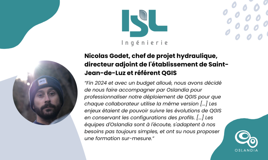
A hydraulic engineer by training, Nicolas Godet has been working at ISL Ingénierie for just…
Caroline ChanlonTuesday October 28th, 2025

Oslandia is pleased to announce the release of the QGIS plugin: QSunPotential, a tool for…
Caroline ChanlonFriday September 19th, 2025