Some news about our R&D activities around machine learning and 3D datasets! This post will present a R&D project, done in collaboration with Géolithe, applied to risk assessment in montainous environment.
Context
One year ago, Oslandia started to work on a R&D challenge that was organized by Imaginove, a french innovation center (now known as Minalogic).
This challenge dealed with country planning in montainous environment, and was part of a bigger project called Univers. The Univers project was set up in order to encourage collaborations between Rhône-Alpes actors involved in digital technologies and geospatial data exploitation.
Actors involved in the challenge: (a) Imaginove/Minalogic, (b) Géolithe, (c) Oslandia
The challenge use case was provided by Géolithe, a french engineering company that focuses on geology, geophysics, geotechnics and civil engineering. Géolithe has a strong expertise in natural risk analysis, especially in montainous environments (that being the challenge framework).
What was expected?
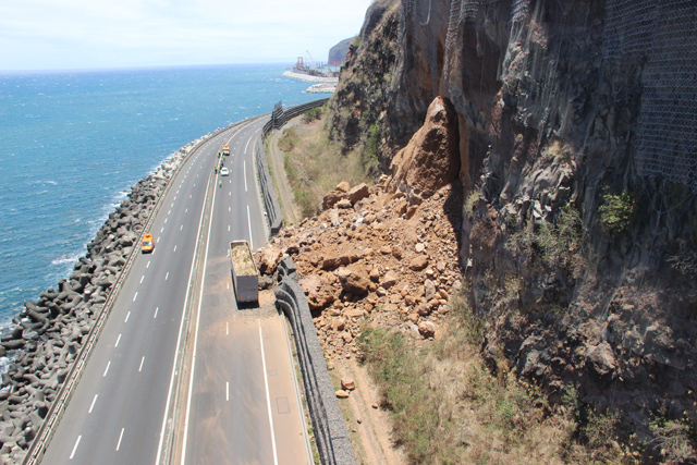
The seminal objective of Géolithe was to assess the risks in montainous environments, by improving the knowledge they have regarding ground taxonomy. The type of ground in a given scene is a seminal parameter in the risk analyse and quantification (regarding crumblings, mudslides, or other montainous hazards).
Crumbling scene in the gorges of the Bourne (Vercors)
As a complement, Géolithe needed to measure and monitor the ground evolution in highly-skewed areas.
What did Oslandia plan to solve the problem?
Oslandia applied for the challenge with the ambition to design an artificial intelligence algorithm based on deep learning. By using its experience in terms of semantic segmentation on 2D datasets (basically, street-scene and aerial images), Oslandia aimed at improving the technical state-of-the-art related to
3D point cloud segmentation, especially in natural environments.
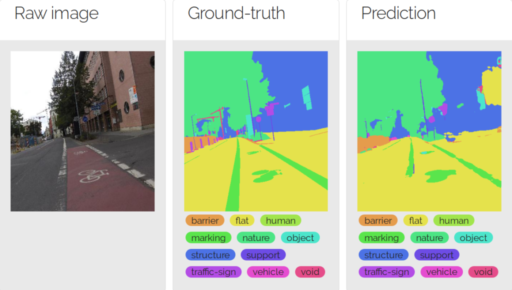
Semantic segmentation on 2D street-scene images
Moreover, Oslandia developed an expertise in terms of 3D data web visualization, through its contribution to the Itowns project. This project was seen as a perfect axe to develop new skills related to 3D data handling.
To be continued…
In the next articles, one will introduce more details about the collaboration between Géolithe and Oslandia. It will give the chance to go deeper into the semantic segmentation topic, with a bunch of hard maths and some machine learning results…
And you, do you have some semantic segmentation 3D use cases? If it is the case, or if you want to discuss about this fascinating topic, feel free to contact us at infos@oslandia.com!