![]() QMapOD is version 2 of MapOD application, initially developed using Access and ArcGis / MapInfo.
QMapOD is version 2 of MapOD application, initially developed using Access and ArcGis / MapInfo.
It’s a plugin for QGIS geographic information system, based on a SQLite / SpatiaLite spatial database. Version 2 of QMapOD brings compatibility with QGIS 3.x.
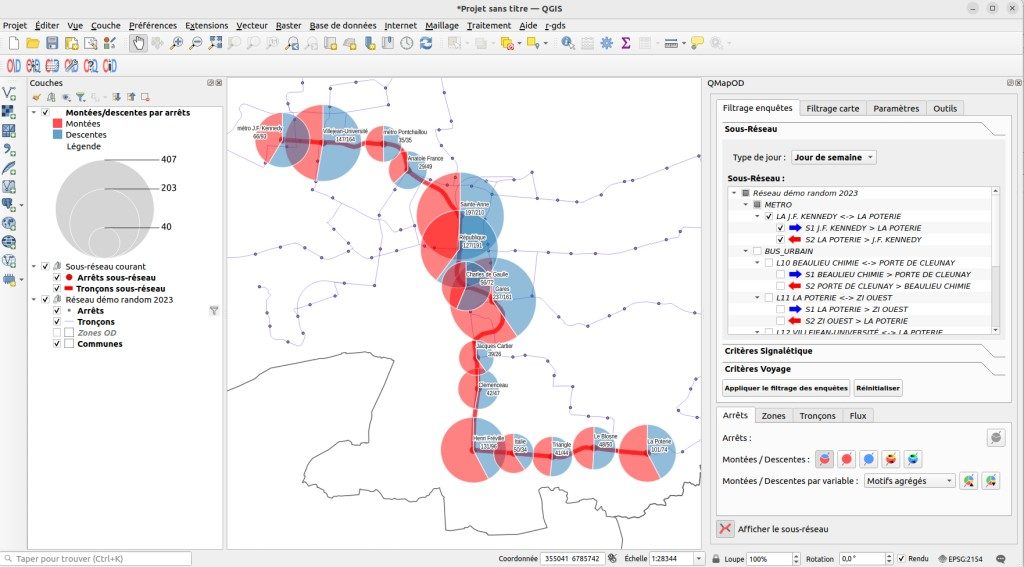
It allows to map the results of origin / destination surveys carried out on a public transport network, by performing out multi-criteria filtering on a survey data set, and then creating cartographic analysis based on filtered data.
Initially developed by SIGéal, QMapOD is now maintained by Oslandia, and funded by Test-SA and Oslandia.
QGIS and QMapOD are distributed under an open source license (GNU General Public License).
The publication by Oslandia of QMapOD on the official QGIS plugins portal aims to attract new contributors and/or new funders to accelerate the development of new features and improve extension reliability.
This publication has already made it possible to industrialize the extension code by aligning it with the standards usually used by Oslandian developers, and by adding to the gitlab repository CI/CD features that contribute to making the produced code more reliable.