The Giro3D team is thrilled to announce the release of Giro3D 2.0.
Giro3D, an Open-Source Geospatial Visualization Project
Giro3D is a geospatial data visualization library for the Web. Free and open-source, it is compatible with many geospatial data sources (rasters, vectors, point clouds, etc.).
Free and Community-Driven
Giro3D is designed to be free and community-driven. We welcome all contributions, whether in the source code, documentation, or testing—there’s room for everyone!
Extensible and Easy to Integrate
Giro3D is built for integration into applications and has been successfully integrated into React and Vue.js environments. Designed as a toolkit for building geospatial web applications, it is also easy to create custom plugins and data connectors for Giro3D.
High Performance
Giro3D leverages web technologies like web workers and GPU-side processing to enable the display of massive datasets such as HD LIDAR or 3D Tiles.
✨ What’s New in Version 2.0
👉 For a detailed description of the changes, you can check the changelog.
Solar Exposure Calculation
👉 See the interactive example
The new SunExposure tool allows you to calculate and visualize the sun exposure of 3D objects such as buildings or terrain over a specified time interval.
This tool takes into account the actual position of the sun on the specified date, as well as the geographic location of the 3D objects, to calculate three solar variables:
- Exposure time (in hours)
- Average irradiance (in Watts/m²)
- Total irradiation (in Watt-hours/m²)
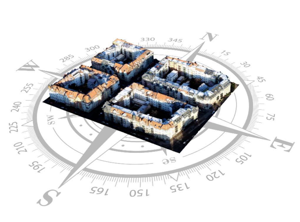
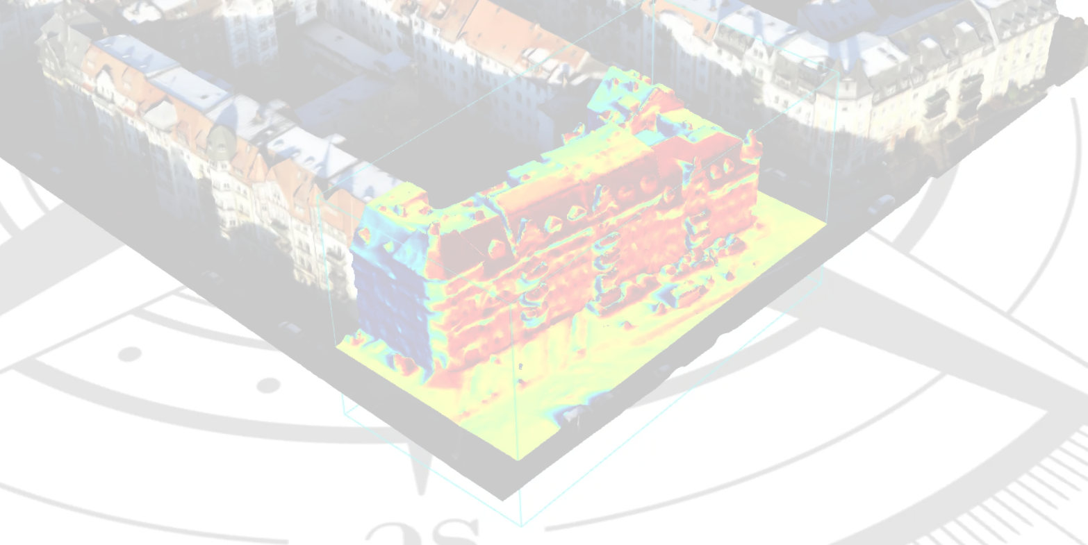
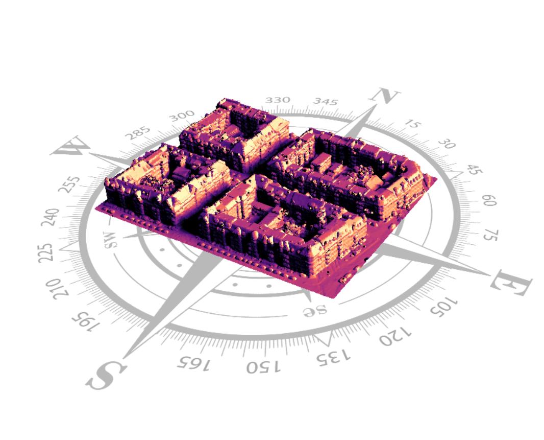
Mesh from photogrammetric capture
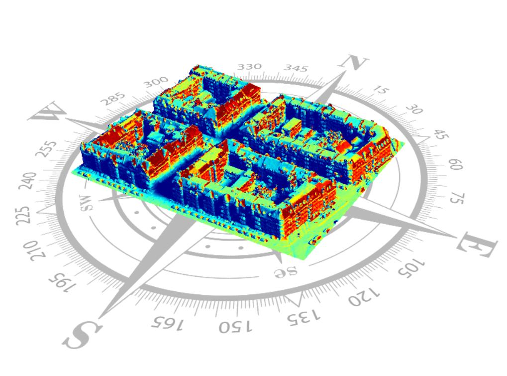
Total irradiation between 6 AM and 8 AM
Average irradiance (in Watts/m²) for the period from 6 AM to 8 AM
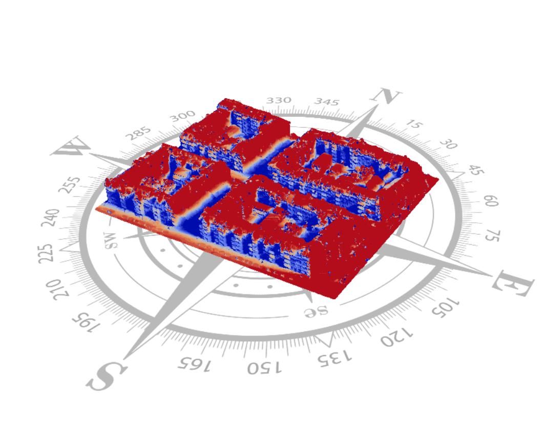
Sun exposure time for the period from 6 AM to 8 AM
OrientedPanoramaCollection
This new entity, similar to OrientedImageCollection, allows you to display a preview of panoramic images. It is a lightweight alternative to the SphericalPanorama entity.
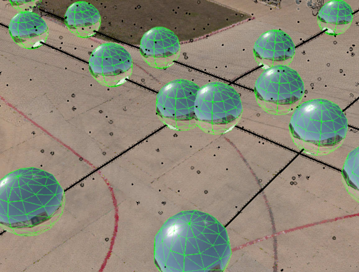
An OrientedPanoramaCollection
DrapedFeatureCollection
This new entity allows you to position features on the terrain of a map. It is an experimental alternative to the existing FeatureCollection.
UrlImageSource
This new source allows you to load WMS-type images while limiting the number of HTTP requests issued by the source. It is now the base class for WmsSource.
![(Fr) [Témoignage client] Julien Girard Claudon, DSI LPO AuRA](https://oslandia.com/wp-content/uploads/2026/03/témoignage-LPO-AuRA-oslandia.png)

