
Context
Oslandia is participating alongside Eviden in the CP4SC project, run as part of the AMI Cloud launched in 2021 by the Banque Publique d’Investissement.
The acronym CP4SC stands for Cloud Platform for Sustainable Cities, and its aim is to help governments implement ambitious policies towards carbon neutrality by ingesting data from different sources such as mobility, energy management or earth and environmental observation.

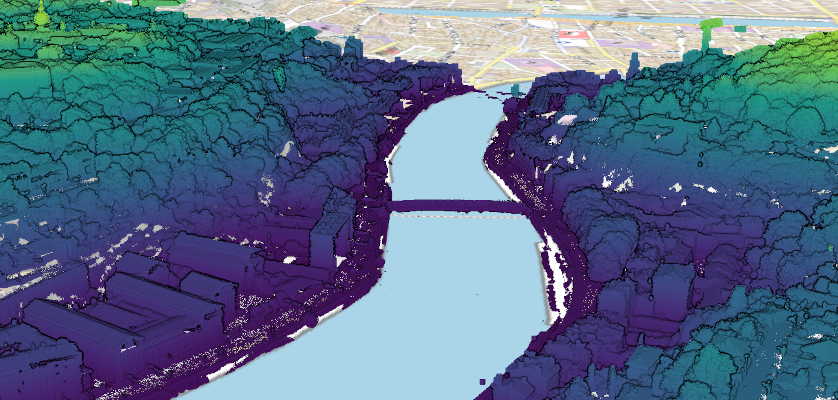
What’s it all about?
3D visualization of buildings is an expectation of many players in urban planning, an expectation that comes up against two stumbling blocks:
- large-scale, structured 3D data is in short supply
- there is no mature software solution for working on a large scale, although some publishers offer proprietary tools capable of working on a building scale.
However, the availability and distribution of large-scale point clouds has grown considerably in recent years: field survey methods and tools have evolved considerably, and many players have taken advantage of this to acquire point clouds (including on a national scale, as is the case in France with the Lidar coverage currently being built up by the IGN).
But while point clouds can be acquired rapidly, they are not immediately exploitable for all types of analysis.
Oslandia’s objective with this project is therefore to offer an industrial processing chain for creating structured data from point clouds, as well as software for exploiting this information, all under an open-governance opensource license of course!
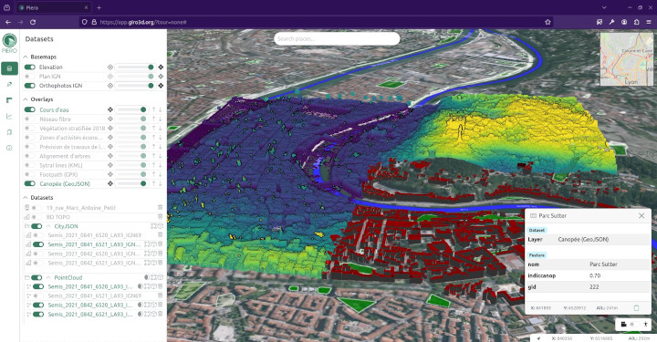
We have already presented the Giro3D and Piero tools for visualizing 3D spatial data. Now we’re going to talk about CityJSON generation !
CityForge
Among the various actions carried out by Oslandia as part of the project, CityForge simplifies the reconstruction of georeferenced 3D data. Our initial objective is to offer a QGIS plugin to facilitate user access to the functionalities of the underlying tools. The CityForge plugin is open-source and free, it is available on GitLab.
CityForge uses :
- the geoflow opensource library, developed by the University of Delft and the 3DGI company. Geoflow has been used to generate 3D buildings for the whole of the Netherlands
- LIDAR ground and surface mapping produced by the French National Geographic Institute (IGN)
- QGIS 3D visualization functionalities
With regard to the project approach, we initially worked on the first prototypal version of CityBuilder in conjunction with an IT development project (PDI), a sequence of the ENSG‘s Master1 Geomatics and Engineering (2nd year) cycles carried out in partnership with Oslandia.
In 2024, work focused on improving the plugin to make maximum use of native QGIS tools, optimize its performance and reduce its technical debt. We also integrated a command-line version of the code.
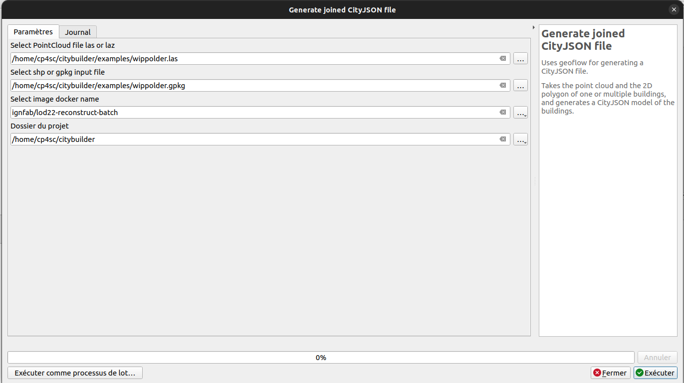
Geoflow has therefore been integrated into a QGIS processing toolbar.
Geoflow generates a JSON output file from a point cloud data file and a building right-of-way data file. We’re using the latest version of geoflow, with LOD Level of Detail up to LOD2.2.
For the ubuntu version, the geoflow docker image used is that of the IGN.
3D data, and now what?
Generated data can be visualized directly in QGIS. This has been made possible by Oslandia’s work on this project over the last two years, which has involved reworking the embedded technical debt, adding tests, correcting anomalies and developing numerous low-level functionalities, so that today we have a much more stable version of QGIS 3D.
As the CP4SC project is cloud-native, it relies on Giro3D and its visualization application, Piero, to display all spatial data, including 3D: reconstructed urban data can therefore also be consulted on the web.
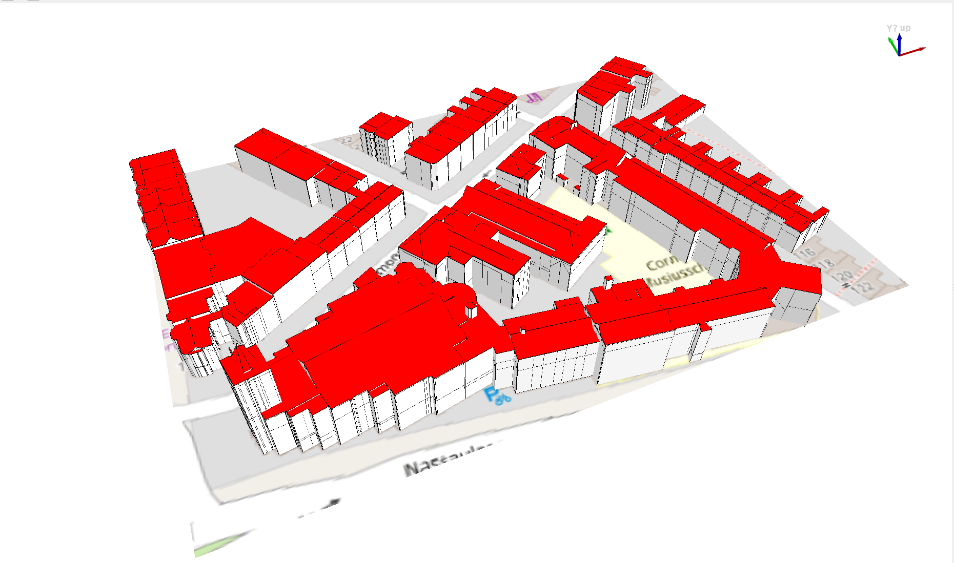
Demo
Contact us
Are you interested in this subject? Would you like to pool your development efforts? Would you like to incorporate these functionalities into your IT platforms? Don’t hesitate to contact us to discuss: infos+3d@oslandia.com


Funded by the European Union – Next Generation EU as part of the France Relance plan

![(Fr) [Témoignage Client] Pierrick Yalamas, Auvergne-Rhône-Alpes Énergie Environnement – TerriSTORY®](https://oslandia.com/wp-content/uploads/2024/02/verbatim-pierrick-yalamas.png)
