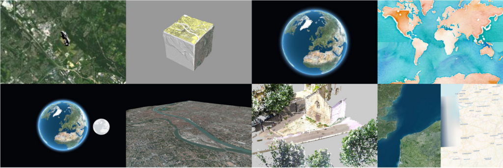
Oslandia, French IGN, LIRIS CNRS Research Laboratory and Atol CD announce the release of iTowns 2, the new version of the OpenSource 3D geospatial data visualization framework for the web. Rewritten from scratch, this new major version allows users to benefit from a solid technological basis, and new 3D visualization features. Its capabilities for software integration and interoperability, as well as its feature range let you build 3D geospatial data visualization applications simply.
New features
This version 2, based on the THREE.JS library, allows for rapid development and integration into existing web applications. iTowns also benefits from the large user and developers community of THREE.JS.
Among the features of version 2.1 :
- Heterogeneous data support (DEM, imagery, point clouds, meshes …)
- OGC 3D Tiles protocol integration
- Globe mode or projected mode in your local coordinates system
- GeoJSON, KMP, GPX Formats
- OGC webservices support (WMTS, WFS..)
- Compatible with Potree format for large-scale point clouds
- post-processing capabilities
Open and collaborative project
iTowns, whose version 1.0 had been developed by IGN research services, is now an open and collaborative project. Oslandia and AtolCD are the main industrial contributors, and actively collaborate on the framework and are involved in projects integrating iTowns as a 3D visualization solution.
MATIS, LOEMI and COGIT laboratories at IGN contribute to the transfer of research work to iTowns, including new algorithms and methods. The IGN Geoportal team is also active and involved in iTowns development.
The CNRS LIRIS laboratory in Lyon, one of Oslandia’s partners, uses iTowns as a common software basis for its research and development efforts. Using an open software allows for faster development, better capitalization of research work and ease of collaboration. The Vilo3D platform from LIRIS is an example of application for geo-historical data visualization with story-telling capabilities. This platform is based on iTowns and currently under finalization.
The project is hosted on GitHub and open to all contributors wanting to take part in the development.
A mature solution for industrial projects
iTowns is now mature enough to be used for industrial software development. Oslandia is currently building visualization applications for large scale PointCloud data for its clients, virtual visit applications or 3D data catalogs. All based on iTowns for 3D visualization.
The project’s roadmap wishes to provide solutions for new use cases in 3D data exploitation : immersive visualization, large volumes of data, precise measurements, augmented reality and any other feature wanted or funded by its users.
Try it out !
Download iTowns and try the demos on the project’s website : http://www.itowns-project.org
Should you need more information or help, contact infos+itowns@oslandia.com .
Oslandia provides a wide range of services around iTowns, OpenSource GIS and 3D geospatial data. Get in touch !

